Duela gutxiko bilaketak
Bilaketaren aukerak
Let's close out the week with a #geoweirdness thread
Today we'll explore the wonderful world of linguistic maps and atlases.
These thematic maps plot diatopic (dia = across, topy = place) distribution of linguistic features such as vocabulary, grammar usage and, most famously, pronunciation.
Let’s get straight to it with a challenge:
Below are three maps. For today’s thread, we’re interested in the info conveyed in just two of them. Can you work out which?
1/
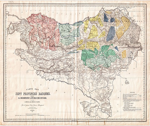
@opencage I loved this thread, thank you! The basque contribution to this collection could be the so called "Bonaparte's map" with the basque dialects back in 1863 https://es.m.wikipedia.org/wiki/Archivo:Bonaparte_euskalki_mapa.jpg
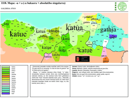
@opencage ... or the basque local dialects atlas: https://www.euskaltzaindia.eus/index.php?option=com_content&view=article&id=565&Itemid=466&lang=eu (in the image, the map for the word cat)


